The Northern Summer Travel — independent group travel 2026
A planning tool that keeps working after you land.
A trip planner built to be used in the field rather than before leaving. It holds one day at a time, works out when to leave each stop, and redraws the day's route on a map when the stops are reordered.
The problem
The details of a trip arrive one at a time, and somebody assembles them by hand into a document that decays from the day it is written. Here that was sixteen days across Denmark, Germany and Iceland for seven people in two households. Every planning tool was good at before and no use in the middle of the day it had planned.
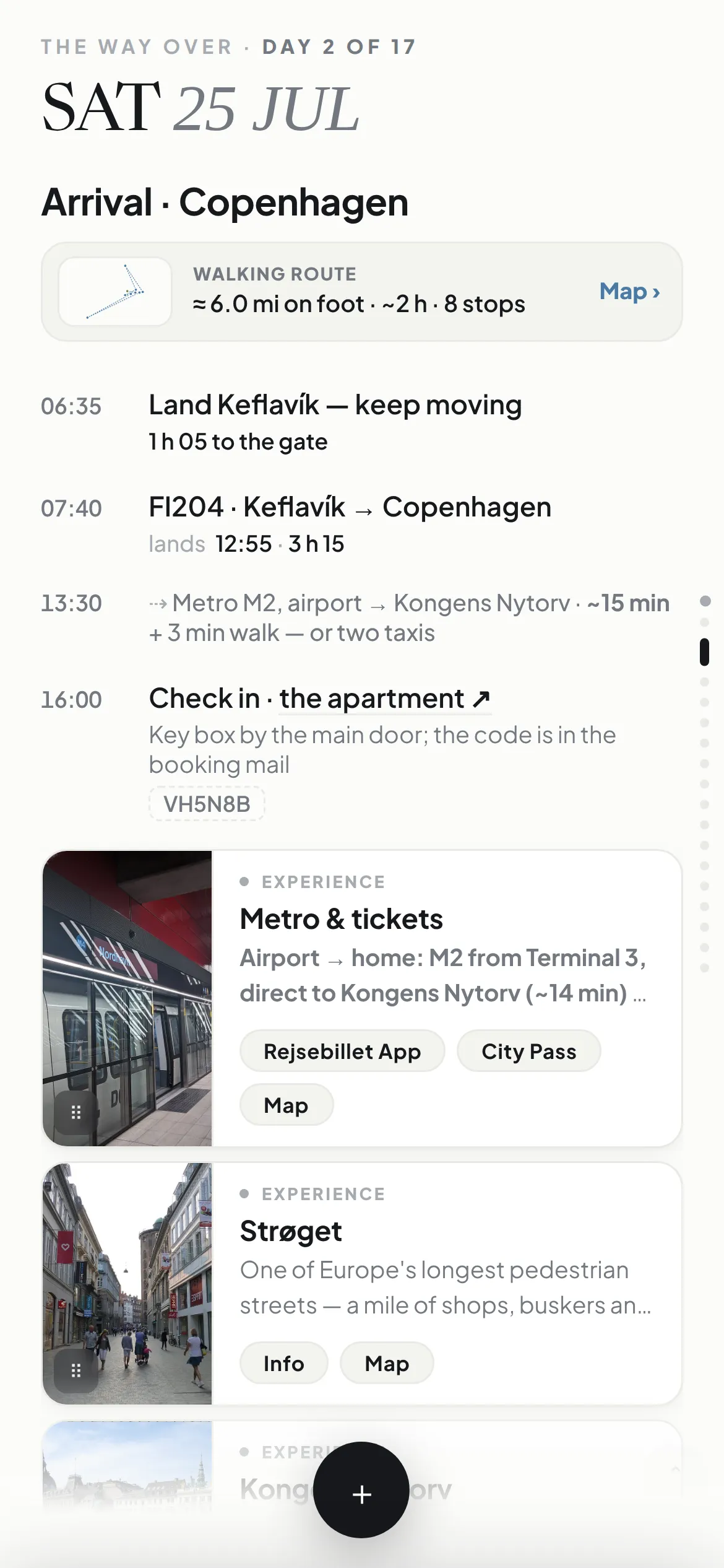
One day at a time, and you move it with your thumb
The system opens to a single day, filling the screen: where you are sleeping, what is booked, what time things happen. Flights, ferries and timed tickets are fixed points and everything flexible arranges itself around them. Nothing from another day is on screen.
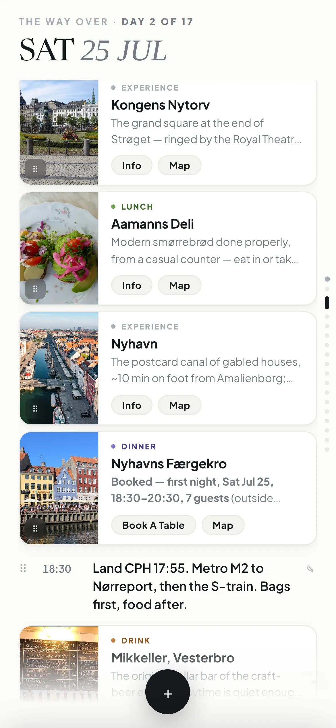
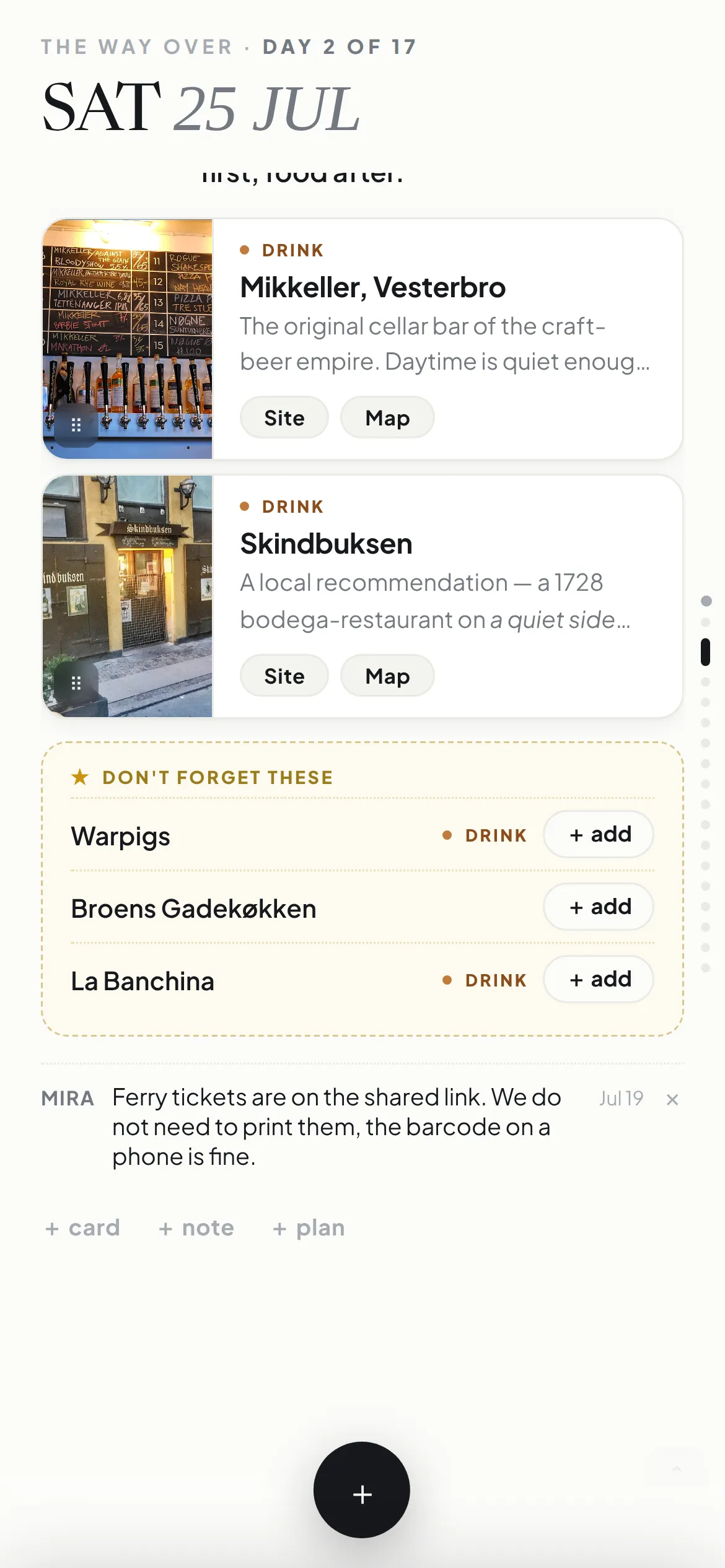
A place worth going is a card, not a line on a list
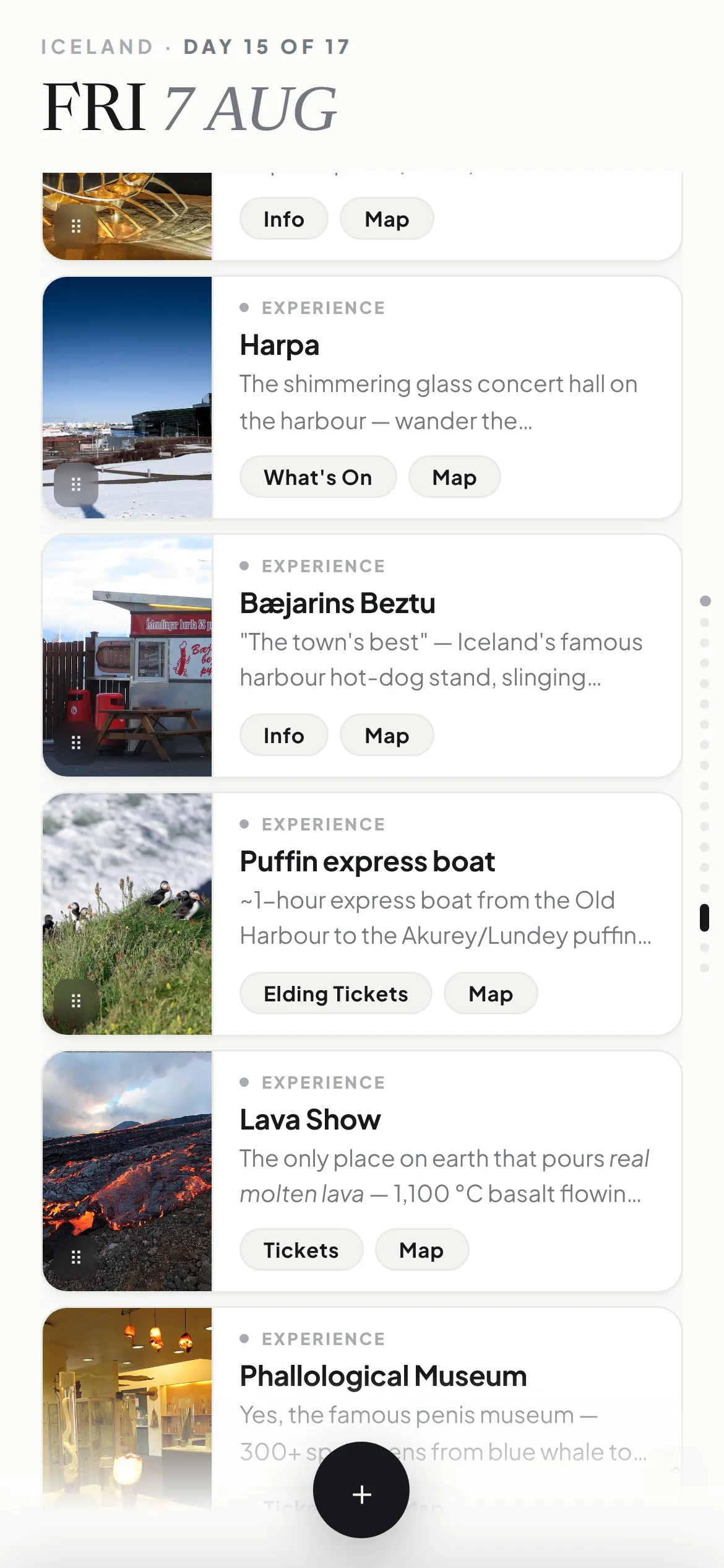
Every experience and every place to eat is a card: a photograph, what it is and why it is worth the detour, opening hours, and the links that matter. The library holds all of them, searchable, and filtered down to things to do or places to eat.
Open the library from a day and a card joins that day in one tap. Nothing is fixed where it lands — cards drag between days and reorder inside one.
It tells you when to leave
Between every stop sits a line showing how you get to the next one — on foot, by bus, by train, by car, how long, where to catch it. Each stop carries an arrival time and each card shows how long you have there.
Those numbers come from the journeys rather than being typed in, so reordering the day recalculates everything downstream. You know the last possible moment you can leave and still make the train.
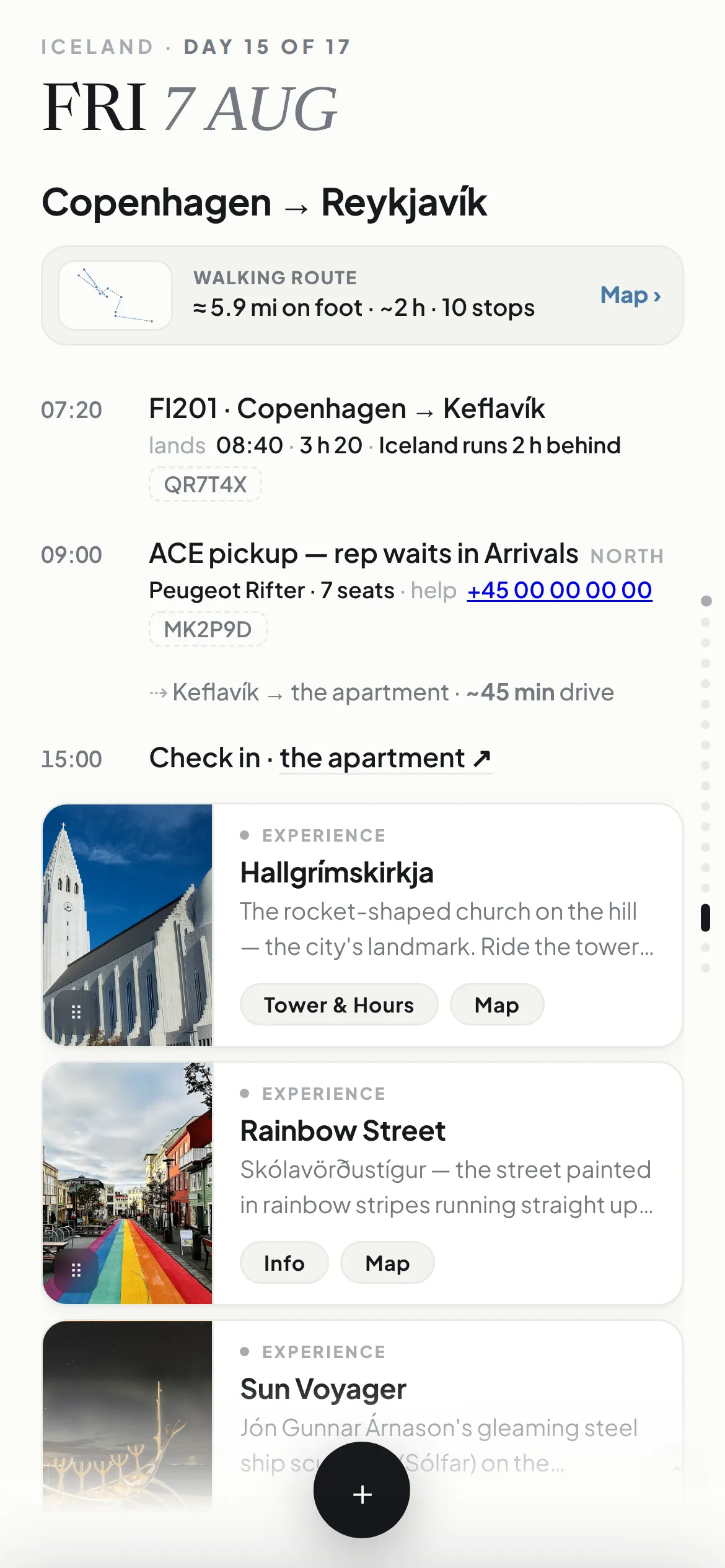
The order of the cards is the order of the route
Each day draws as a route on a real map, and it starts from wherever you are sleeping that night rather than from the middle of the city. Walking, driving or transit, with the distance and the time the whole day takes.
Move a card and the map redraws. That is the step that turns a set of places worth seeing into a sensible way round the city — the question stops being what do we want to do and becomes what order does this go in. Where you actually start walking, it hands off to the phone's own navigation.
The rest of it
- The forecast sits on the day it applies to — a high and a low against each date, and a summary for each leg on the overview.
- Every booking reference is in one place — flights, ferries, rooms and rental agreements collected in one view, and repeated on the day each one applies to, a tap to copy.
- The converter opens on the currency you are standing in — three currencies, converting both ways. It reads location where it can and otherwise takes the leg the calendar says you are on, so it is right before you land as well as after. Each carries a rule of thumb for doing the sum in your head instead.
- Share it without losing control of it — one link gives a read-only view of every day, place and map, with editing removed.
- Something saved without a date comes back — an undated card resurfaces later on the days you are close enough to it to actually go.
- It gives you something to say — each significant stop carries four or five facts written to be spoken: why an inscription was resisted for twenty years, what half a million people did five days before a wall opened.
What changed
The trip ran sixteen days across three countries with seven people, off this system, daily.
- The information stopped being scattered. Every booking and every place in one place, with one current version.
- The planning stopped being a document. Changes made in the field took seconds and reached everyone instantly.
- The blind spot closed. Both households and family at home saw the live plan through one link, with no risk of anyone altering it.
- The last mile got solved. Departure times, transit legs and time-at-each-stop turned a plan into an operating schedule.